
Important Freshwater Area pilot is underway
20th August 2015
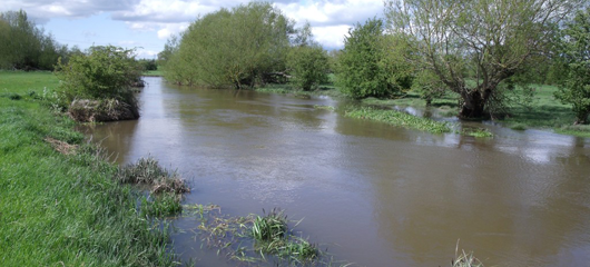
An Important Freshwater Area pilot begins in Oxfordshire this month to help protect and extend the most important sites for freshwater wildlife.
Important Freshwater Areas are parts of the landscape with concentrations of vulnerable and endangered freshwater species, and high quality freshwater habitats. This pilot project, run by the Freshwater Habitats Trust and the River Thame Conservation Trust, has secured funding from the Patsy Wood Trust to make information about those key areas available so that vital, targeted action can be taken to protect freshwater wildlife.
Traditionally it has been assumed that protecting larger rivers and lakes would be enough to maintain freshwater wildlife, and most work is still done on these larger habitats. However, research has clearly shown that freshwater wildlife exists in networks of habitats large and small and that, surprisingly, the small waters – especially ponds, ditches, small streams, springs and flushes – support more species, and more endangered species, than the larger rivers and lakes. Although this is now widely understood by specialists, there is still no single map or database which identifies all of the important sites for freshwater wildlife, with the information scattered in a wide range of sources. As a result, it is very difficult for people, organisations and authorities to prioritise work to protect and extend the most important sites for freshwater wildlife, a process which will be essential if we are to reverse the decline in freshwater biodiversity.
This project will pilot the process of creating a single publicly accessible map and database identifying Important Freshwater Areas and then demonstrate its use by (a) developing and testing new citizen science survey methods to fill in data gaps and (b) using the map to prioritise practical conservation projects in the Oxfordshire, with a specific focus on the River Thame catchment.
Important Freshwater Areas may be groups of unpolluted ponds supporting endangered water plants, headwater streams supporting isolated native crayfish populations, tiny calcareous springs and flushes supporting endangered aquatic craneflies and rare mosses, stretches of rivers with endangered animals such as the Thames ram’s-horn snail, unpolluted gravel pit lakes with stoneworts that require exceptionally clean water or areas with networks of all these habitat types.
There is very little information about how the plants and animals in these habitats are faring, so this project will trial a new citizen-science monitoring programme, building on the experience of the national PondNet project. Local people will help to collect data from all parts of the freshwater environment and test new citizen science methods. The information they collect will be added to the Important Freshwater Areas database and map.
The Important Freshwater Areas map will then be used to target the practical work needed to protect and build out from key freshwater sites, helping to recover and sustain freshwater wildlife. The project will support other local initiatives to learn about and understand Important Freshwater Areas, and plan their freshwater protection and enhancement work accordingly.
There will also be three practical demonstration projects which will help protect and extend populations of threatened freshwater species. Final locations for this work will be chosen once the database is completed but could include protecting the only brown trout populations in the River Thame catchment, increasing protection for an important freshwater biodiversity hotspot, and making new clean water ponds.